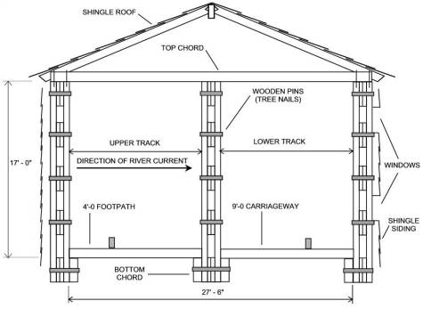
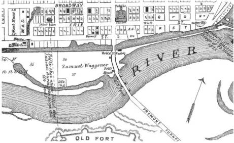
|
This
1875 map clearly shows the location of the 1849 bridge and its three
piers. The tollhouse of Mr. Goss is located adjacent to the roadway on the
Maumee City side of the river. The Lautzenheiser Bros. “woolen
factory” is shown on the SideCut Canal north of Mr. Goss’ tollhouse. I
searched for more than a year in libraries and private collections, but
was unable to locate a known photograph of this bridge. Map
From Andreas & Baskin’s Illustrated
Historical Atlas of Lucas &
Part of Wood Counties, Ohio (1875) |
|
The
1849 Toll Bridge, constructed in only 45˝ days by Amos Campbell of
Woodbury, New Jersey, was a huge structure for its day. The
sketch shows general dimensions of the Town’s Lattice Truss bridge.
“Upper” and “lower” designations refer to the normal direction of
water flow in the river. In
1880, the Commissioners condemned the bridge, closing the upper track and
posting a warning sign advising those seeking passage on the lower track
that they did so at their own risk. Sketch
by Author
|
Copyright
© 2003 by G. L. Franks, PE / All rights reserved.
Revised: 13 Jan 2018 09:14:43 AM
.